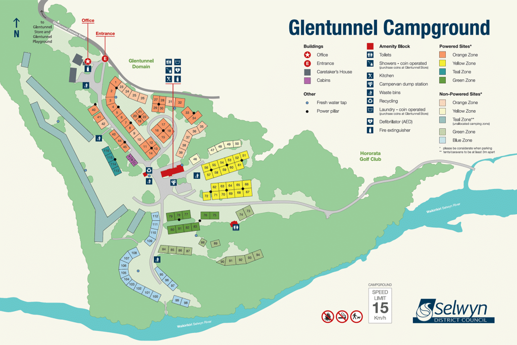
Glentunnel Campground Plan Map

Xyst worked with Council to ascertain the campground extent and stitched together drone aerial photos for the site to form the basis of the underlying map.

Xyst then determined the styling and information the client wanted displayed as labels and notes on the map, including locations, number and sizes of sites, amenities, key recreational facilities, nearby tourism connections, tree outlines and regulatory notes, along with map legends, north point and scale.

Xyst drafted the plan in Adobe Illustrator then finalised the plan, following client feedback, to produce a high-quality plan for print and installation.

Project Benefit

Xyst worked with Council to produce the Glentunnel Campground map to be used by those visiting or intending to book a site at the campground, as well as for wayfinding and informative purposes on site. The map will be used as an A4 handout to guests on arrival and on the campground signage at A0.
Client organisation
Selwyn District Council
Landscape Architecture
Mapping and Geospatial Analysis
Signage Design