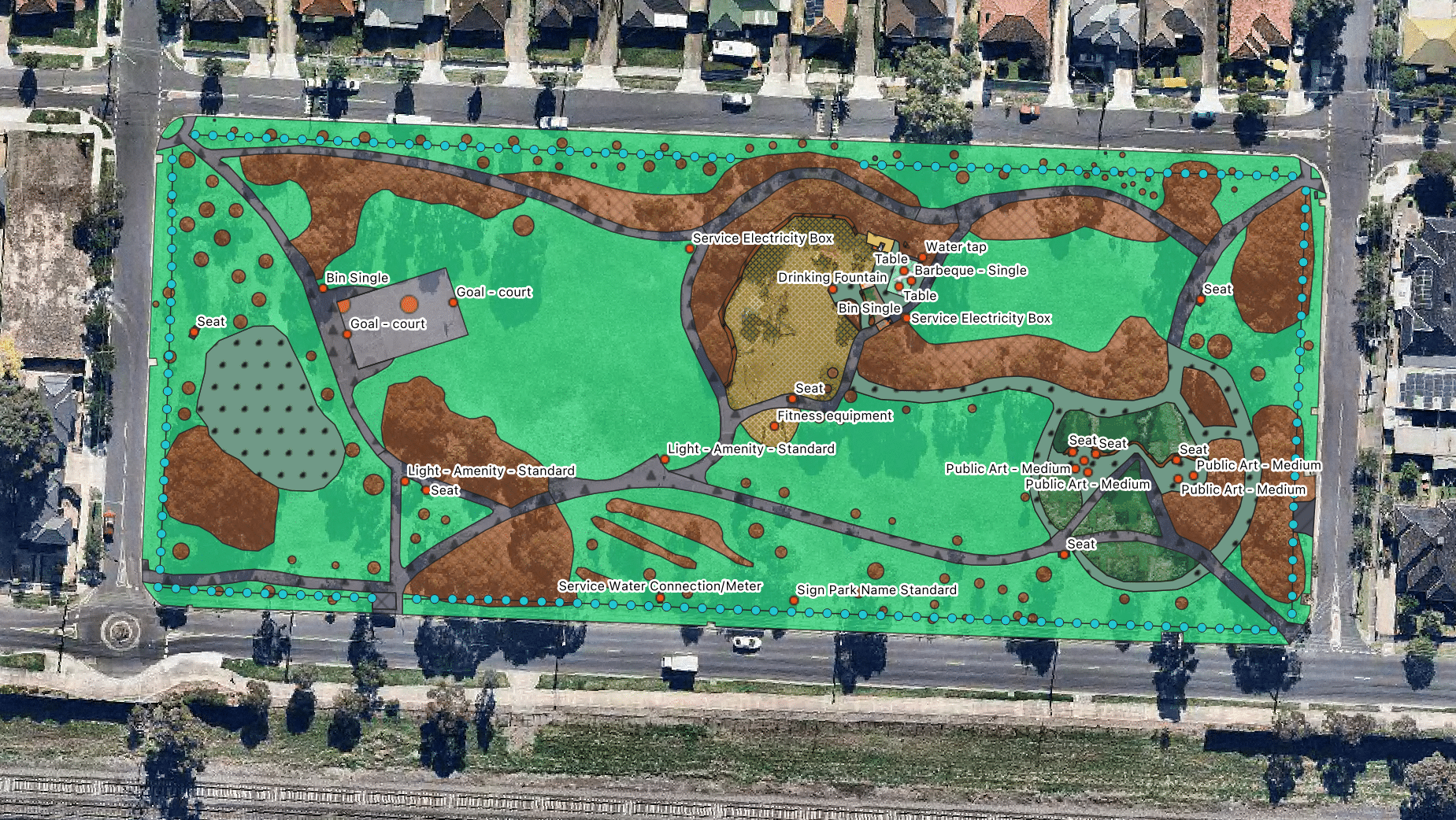
Xyst carried out GIS mapping of 32 Suburban Parks within the Brimbank City Council area, identifying shapes and point locations of park asset categories.
This mapping will support the councils performance-based approach to maintaining the parks.
I have over 30 years’ experience in the horticulture, parks and open spaces, community facilities and customer service sectors. I have been involved in contract management, business development a...
We use cookies to ensure that we give you the best experience on our website. If you continue to use this site we will assume that you are happy with it.