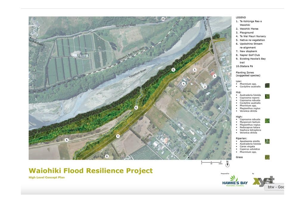
Xyst worked with Council’s appointed engineering firm to import a current geo-located drone aerial image and the developed engineering set for the new stop bank and stream extent and alignment to aid the in the development of a high level concept plan and visualisation.
These showed the proposed new stop bank, stream alignment and new native riverside and stream riparian planting succession at maturity in relation to the surrounding Waiohiki Marae and community.


