Waititi Trout Stream Holiday Park Development Plan
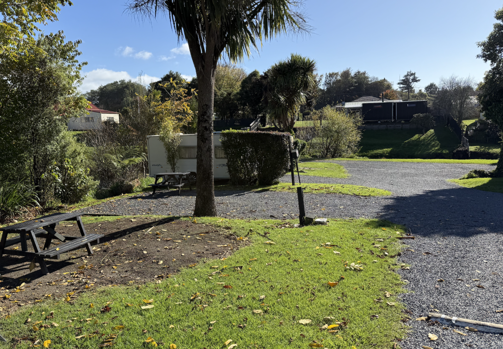
Xyst undertook a full review of the consenting history and regulatory and planning requirements for the Holiday Park. We coordinated a full site survey, geotechnical investigation and services investigation. Using this information we developed a long term concept plan for the redevelopment of the site. Xyst also project managed the first stage of the redevelopment.
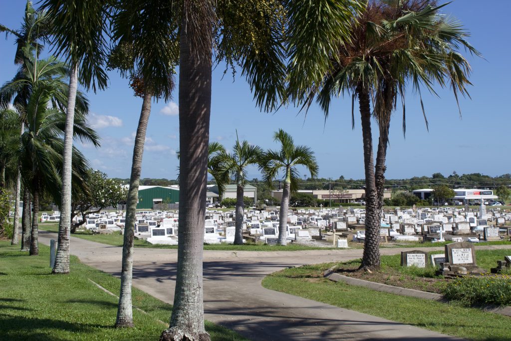
Russell Kororareka Cemetery
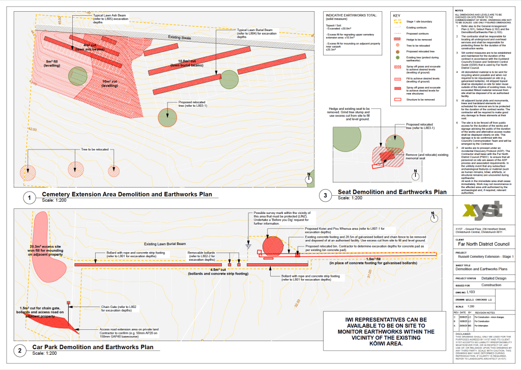
Extension Detailed Design Xyst delivered the Detailed Design for the Russell / Kororareka Cemetery Extension, providing a comprehensive set of landscape architectural drawings, a landscape specification, and a schedule of quantities for the contractor to price and implement the works. The detailed design translates the approved concept plan (initially undertaken by Xyst) into plans for […]
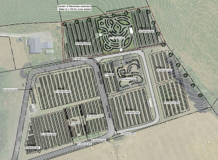
Russell Kororareka Cemetery
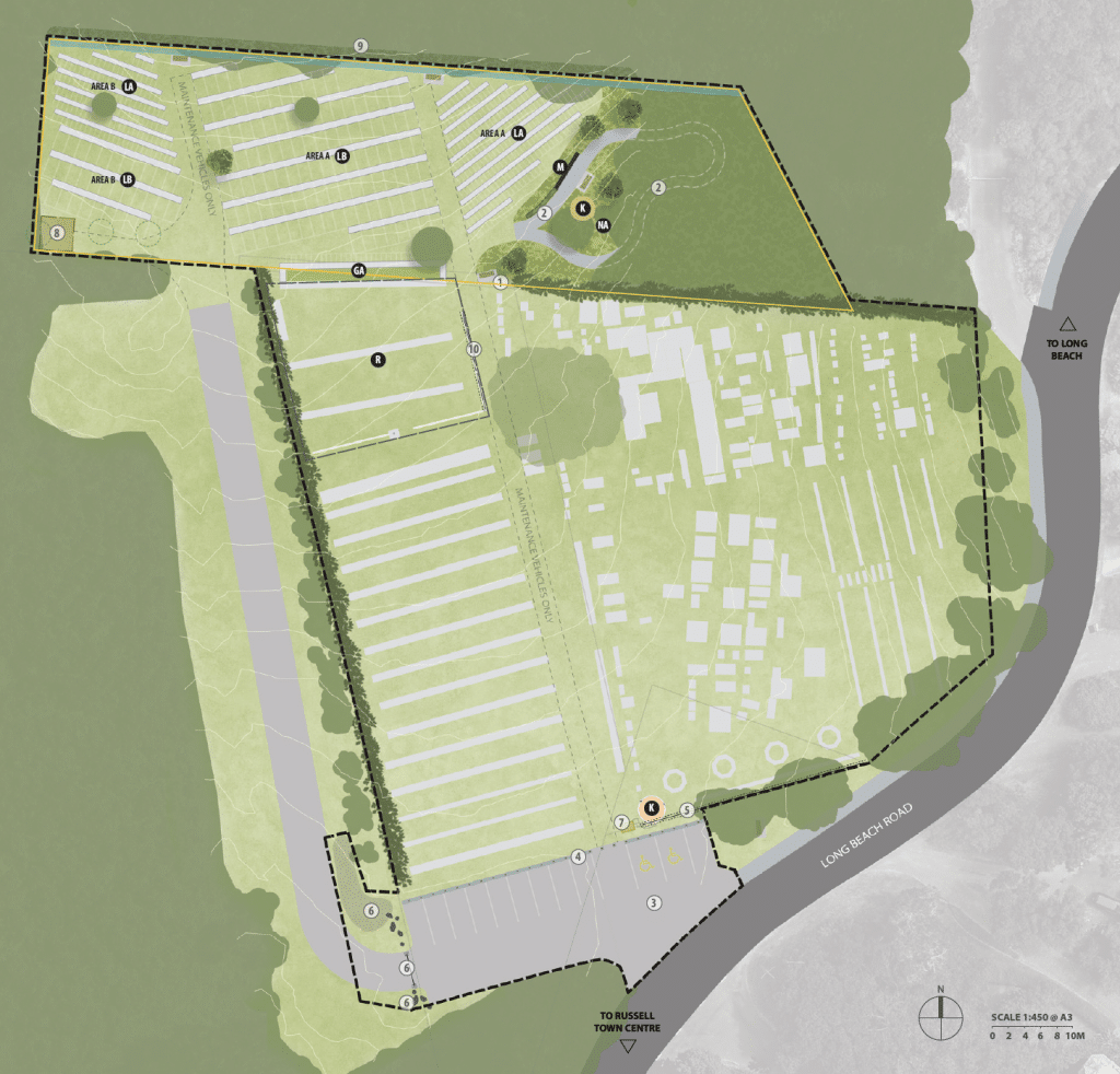
Extension Concept Plan Xyst worked with Far North District Council to develop a concept plan for the Russell / Kororareka Cemetery extension in the Bay of Islands. The project aimed to expand the cemetery by 2,272 m² to meet future interment needs while respecting the site’s cultural significance and scenic hillside location. The project involved engagement […]
Masterton Cemeteries
Network Capacity Review and Site Analysis Report Xyst worked with Masterton District Council to assess the future capacity and management of six of the district’s council-owned cemeteries: Pioneer, Archer Street, Riverside, Mauriceville West, Hastwell, and Tinui. The project involved analysing interment records, demographic trends, population growth, and evolving community preferences, supported by desktop site investigations […]
Te Kuiti Cemetery Extension Plans
Xyst reviewed local interment trends to understand future needs and ensure the cemetery can continue to serve the community well into the future. These insights informed the cemetery extension design, helping allocate space thoughtfully across a range of interment options. In planning the extension, we placed strong emphasis on: – providing for the community’s ongoing […]
Cemeteries Network Masterplan
The Masterplan focused on the potential expansion of interments and the range of interment types across the three cemeteries: Bowen, Proserpine, and Collinsville. Xyst developed modern service options within the Masterplan’s framework and outlined layouts for each cemetery, taking into account plot types, arrangement, land management, access, shade, wayfinding, and ecological upgrades to create a […]
Cemeteries Masterplan
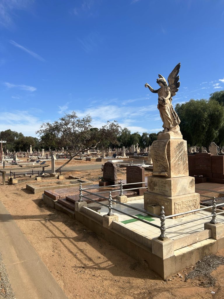
Xyst conducted a review of interment trends, to predict the percentage of interments within the region’s cemeteries. This will support the development of options to inform the strategic and network framework Masterplan, and to guide the future expansion, development, and management of the Port Pirie regions’ cemeteries. This will provide high-quality spaces that; cater for […]
Play Value Assessments
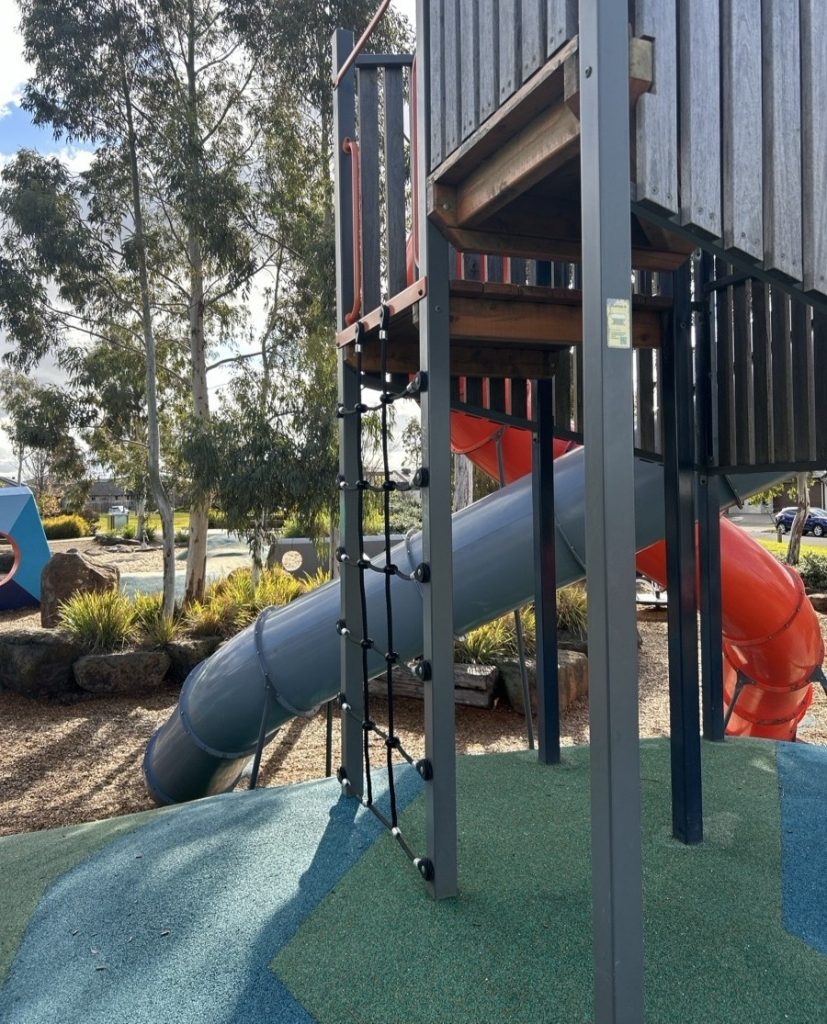
Xyst completed a comprehensive assessment of over 200 playgrounds and skate facilities to evaluate their overall play value. As part of this project, we developed a set of agreed service levels to guide the appropriate scale and type of development for each playground category. These service levels helped define key elements, such as: • Target […]
Pōmare Park Development
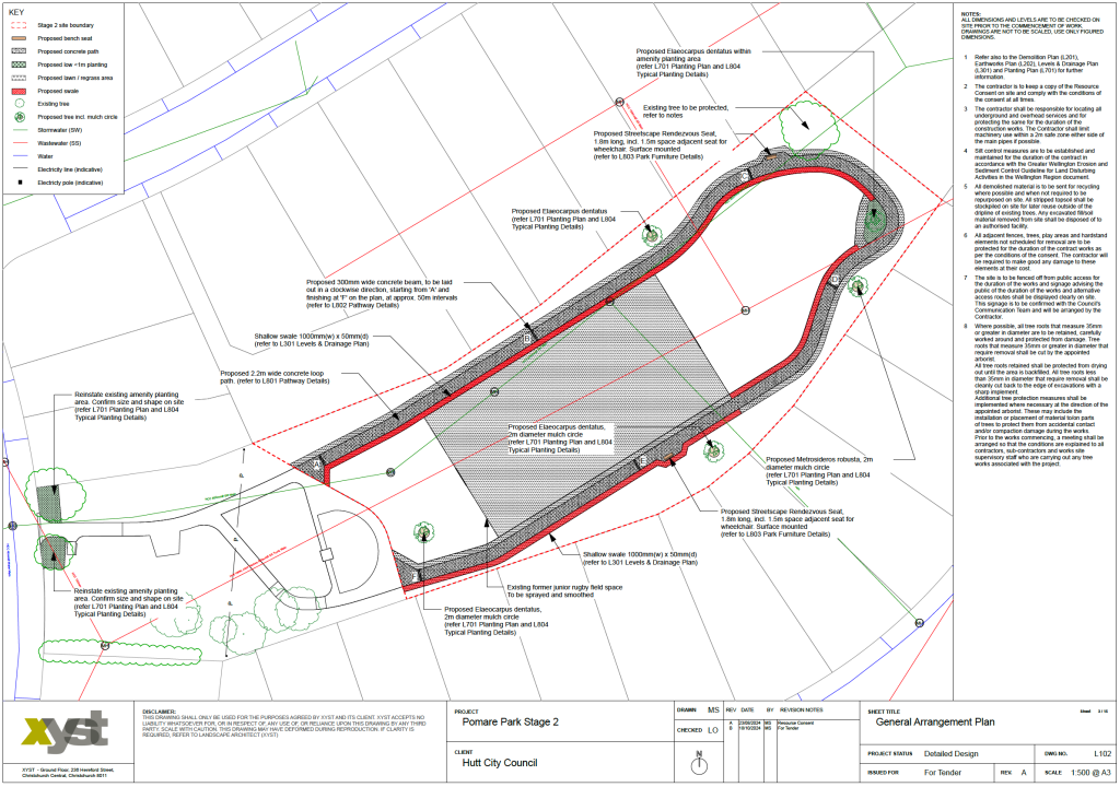
Detailed Design (for Stage 2) Xyst worked with Hutt City Council to prepare a full detailed design set for consenting, tender and construction as part of the Stage 2 upgrade works.
Hall Crescent Reserve
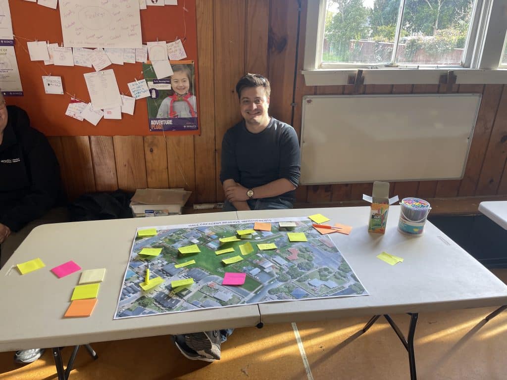
Engagement, concept and detailed design Xyst was commissioned by Hutt City Council to enhance the recreational amenities of the existing reserve following subdivision, with a focus on strengthening connections to the surrounding community. To ensure the design met local needs, Xyst conducted targeted community engagement with the Epuni neighbourhood and other key stakeholders. This process […]
Haumoana Domain
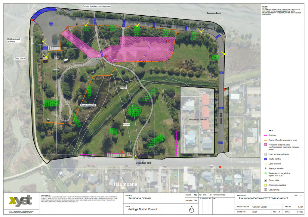
CPTED Site Assessment and Recommendations Report Xyst undertook a high-level desktop analysis of Haumoana Domain, to review current and historic information alongside a high-level crime analysis using NZ Police Crime Snapshot. Xyst completed three visits to the Domain to conduct the CPTED site assessment – two during the day and one at night. To better […]
Bodle Drive Concept Plan
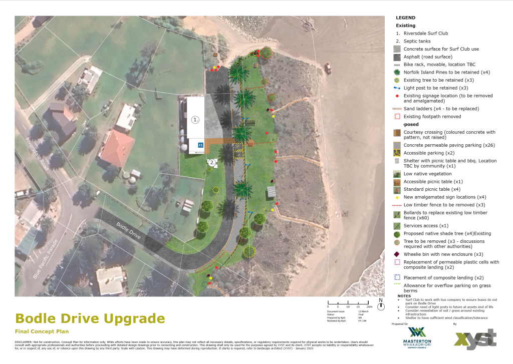
Riversdale Beach Xyst undertook key stakeholder engagement in the development of the draft concept, followed by wider public consulation through the Placechangers platform. The feedback helped refine the design, resulting in a concept plan that includes improvements to parking, pedestrian safety, beach access, ecology, shade and shelter, amenities, and way-finding. The work supports the next […]
Christie Park Upgrade – Concept Plan
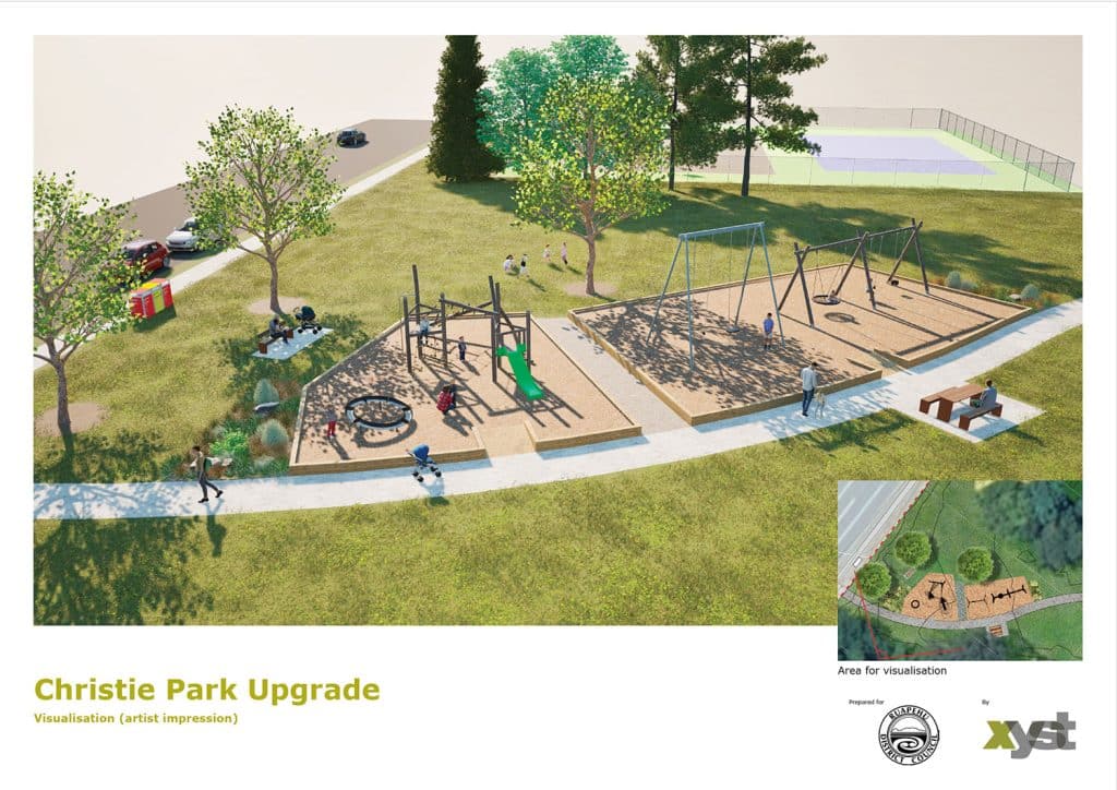
Xyst reviewed the earlier engagement reports and original designs (prepared by others), along with feedback from the local community board, to rationalise the design while retaining key recreational and amenity elements. We produced an aerial concept plan, material palette, 3D visualisation and detailed costing estimate. The result is a refined design that achieves much of […]
Drone Aerial Imagery of Parks and Reserves
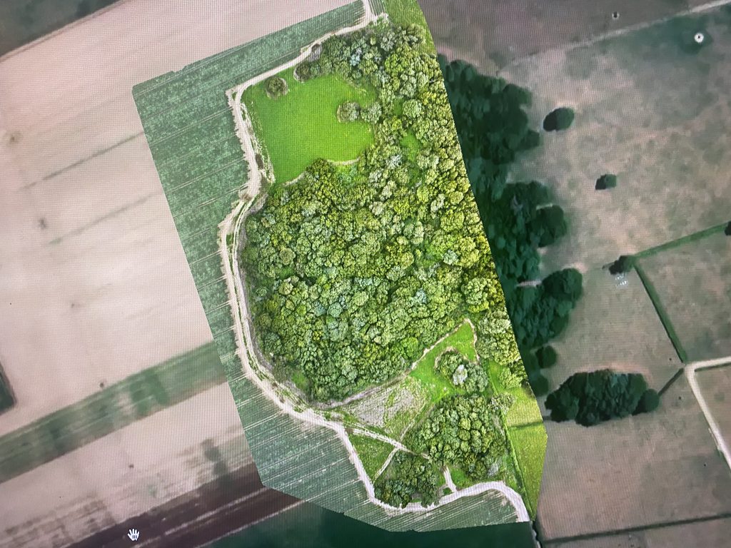
Xyst completed aerial mapping (using a drone) of rural land and reserves to provide a new orthomosaic image to be used for GIS, planning and future concept plan development (including planting/revegetation options). Xyst also captured images that provide a 360 spherical view of the reserve and the surrounding land areas, that can be used in […]
Glentunnel Campground Map
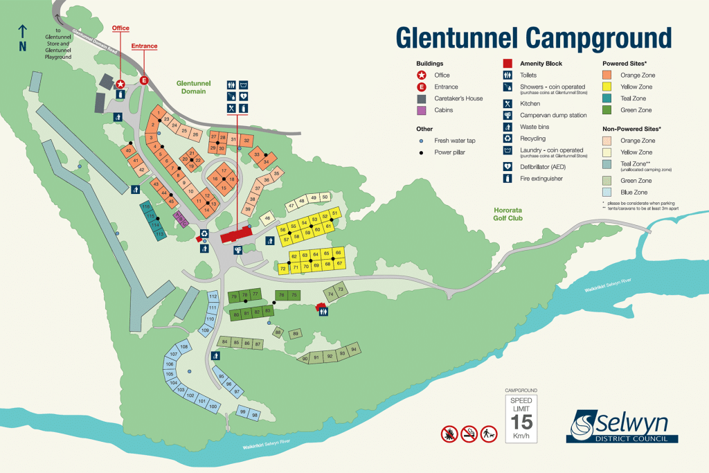
Xyst worked in collaboration with Selwyn District Council to create an updated and accurate map layout of the campground to guide visitors through the upgraded space. The map was crafted using high-resolution drone imagery and incorporates essential features such as campsite locations, amenities, recreational facilities, and nearby attractions. Clear labeling, legends, colour-coding and directional markers […]